22 02, 2019

5.1 Explore My Land

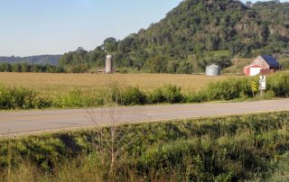
The Agricultural Conservation Planning Framework (ACPF) is a computer model that uses high-resolution geo-spatial data to show existing and suggest locations that may be good possibilities for additional flood reduction or nutrient removal practices, including Water and Sediment Control Basins (WASCOBs), Contour Buffer Strips, Grass Waterways, Nutrient Removal Wetlands, Drainage Management Areas, and Bioreactors. Any of these man-made 'structural' practices installed on the land should of course be combined with good 'soil health' practices. The ACPF model is far from perfect — it does not recognize the many sinkholes on our Northeast Iowa landscape, it doesn't necessarily reflect recent [...]

20 02, 2019

2.1 Stream, River & Watershed Designations

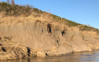
Canoe Creek 2.1.1 Stream, River and Watershed Designations There are many different state and federal designations for the surface waters in the Upper Iowa River Watershed. These designations recognize the significance of the natural and recreational resources in the watershed and can impact various regulations and requirements associated with farm operations. Some designations can and have changed over time and others garner higher priority for state and federal program funding. Download printable version of the Stream, River and Watershed Designations Story Map

24 01, 2019

1 Community Engagement

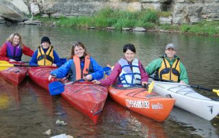
Implementation of the UIR Watershed Resiliency Plan will require action by public and private residents and organizations in substantial portions of three very rural Iowa counties and a very small area of a fourth Iowa county, as well as multiple small communities and villages. Since upper portions of the watershed encompass areas of three Minnesota counties, it is very important that Minnesota residents and partners also take action. Funding from a Disaster Resilience Grant provided resources for planning in the Iowa portion of the UIR Watershed. Minnesota partners are utilizing other [...]

22 01, 2019

2.4 Unique Species and Ecosystems

Photo Courtesy Larry Reis According to Iowa DNR there have been 204 documented unique occurrences of threatened and endangered species and natural communities in the Iowa portion of the Upper Iowa River Watershed. The Iowa Natural Areas inventory (INAI) is a collection of threatened, endangered, special concern and selected rare species defined as unique. This data is available to the public via the Natural Areas Inventory Interactive Mapping. Species documented in Upper Iowa River Watershed counties include: Winneshiek County contains 130 unique listed species of plants, animals and invertebrates, Allamakee County is home to 171 unique listed [...]

16 01, 2019

5 Subwatershed Explorer

Iowa BMP Mapping Project - Existing Conservation Practices ACPF Model: Potential Locations for Structural Practices Find My Subwatershed Explore My Land 5.1 What is a Subwatershed? The 640,000 Acre Upper Iowa River (UIR) Watershed can be subdivided into subwatersheds with each individual subwatershed representing either an area of land that flows to a stream that is a tributary of the UIR or an area of land directly adjacent to and draining directly into the UIR. The US Geological Survey (USGS) has officially delineated 34 subwatersheds, which they describe as being “nested” in the [...]

24 09, 2018

Watershed Plan

The Upper Iowa River Watershed Resiliency Plan was developed by Northeast Iowa RC&D on behalf of the Upper Iowa River Watershed Management Authority (WMA) Board over a two year period from February 2017 to March 2019 with input from dozens of contributing partners who conducted research, analyzed opportunities, facilitated public input and recommended strategies and actions. The UIR WMA Board assisted with many aspects of the plan’s development, including community outreach, engagement, and education, as well as content development and review. They ultimately approved the plan and continue to actively work toward its implementation. Although the plan was brought together [...]

21 09, 2018

2.6 Demographics

Each of the Upper Iowa River Watershed counties, as well as the watershed residents within each county, face different watershed and conservation challenges associated with 1) the percentage and landscape position of the watershed within their county, 2) the percentage of the county encompassed by the watershed, 3) the number of total acres in the watershed. Counties with small upland areas of the watershed, such as those in Minnesota and Mitchell County in Iowa, don’t have to deal with the flooding associated with the UIR but their land use and conservation decisions greatly impact downstream counties and producers. Counties [...]

19 09, 2018

7 Upper Iowa River Watershed Organizations (In Progress)

Local partners working in the watershed (Tell us about your work!) Soil & Water Conservation Districts Allamakee County Soil and Water Conservation District Howard County Soil and Water Conservation District Howard SWCD on Facebook Winneshiek County Soil and Water Conservation District Winneshiek SWCD on Facebook Counties & Cities Allamakee County Engineer Allamakee County Supervisors City of Decorah City of Lime Springs City of Calmar City of Cresco Howard County Engineer Howard County Supervisors Winneshiek County Emergency Management Winneshiek County Engineer's Office Winneshiek County Supervisors Non-Profit Organizations Northeast Iowa Resource Conservation & [...]

19 09, 2018

2.2 Land Cover and Land Use

Land use and land cover in the Upper Iowa River Watershed is more diverse than many other Iowa watersheds. Acres of woodland, grassland, pasture, wetland and restored native prairie are abundant in large part due to the topography but also due to deliberate choices made by private and public landowners. Cropland acres are more dominant in the western and southern areas of the watershed and residential/commercial development is minimal. There are only a few small towns and villages. According to National Land Cover Data, the Upper Iowa River Watershed has relatively low row crop intensity; cropland accounts for only [...]

19 09, 2018

2.3.2 Soils

Soils are one of the most important components of the UIR Watershed, impacting watershed health, ground and surface water quality, and economic vitality. They also hold the single greatest potential to reduce flooding and improving water quality across the entire watershed. The type, health, natural and artificial drainage, management practices, slope, and biological characteristics influence soil water holding capacity, infiltration rates, runoff potential, nutrient mobility, erosion, and productivity. Poor quality, compacted soils do not infiltrate , whereas healthy soils can act as a sponge. The organic matter and biology in the soil creates soil aggregates [...]

Go to Top